
AI video analytics · Traffic
Smart traffic: counting, plate reading, tracking
An AI camera system for traffic: counting by lane, license plate recognition, cross-route vehicle tracking and flow analytics for cities.
Industry challenges
Post-incident review is needle-in-haystack work
One incident means watching hours of video across many cameras. Without search by plate or time, reviews drag on and details get missed.
Watch-listed vehicles slip through
A previously offending plate or a watch-listed car returning to the area: without automated matching, it is caught only if someone remembers the plate.
Congestion management runs on no data
Which interchange jams, from what hour, at what density: without per-lane measurement, flow plans rest on observation alone.
Violations caught only by staffed posts
Red-light running, wrong-way driving, speeding and illegal stopping along a long route: staff cannot stand at every point at once.
Solutions by area
Intersections and corridors
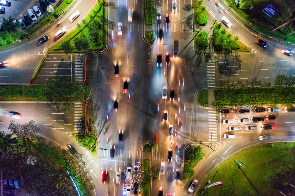
Counts vehicles per lane and turn direction at intersections, tracks speed and auto-tags speeding and red-light running (Traffic Management module, separate license; cameras must see the signal head clearly). Hourly density heatmaps pinpoint recurring choke points; historical figures chart in Vaidio Data.
Plate and vehicle recognition
Reads license plates from route cameras (separate license), including two-row motorcycle plates; with the make and model engine enabled (separate license), each pass records the make and model across 2,000+ vehicle makes and models. Search the archive by partial plate, color, or make and model.
Public order
Plates are matched against watch lists and flagged the moment a listed vehicle appears; a vehicle's route is rebuilt across cameras along the corridor (cross-camera vehicle tracking, separate license, tuned for passenger cars) and event video exports for investigation.
Toll plazas and parking
Trip counts by vehicle class feed peak-hour analysis and planning; station and parking access is managed by plate.
Can be enabled later
Detects objects left behind at stations and parking lots: pick the object type upfront and get an alert when it sits unattended past the set time. Scene change detection along the route reports flooding, landslides and debris blocking the road. Camera health monitoring shows instantly which camera on the route is blocked, misaimed or offline.
What you get
Video along the route becomes data and records for operations and post-incident review.
Incident review by query
Find the vehicle tied to an incident by plate, make, model, color and time window across the route's video archive; results come back in seconds.
Watch-listed vehicles never slip through
A registered vehicle appearing on any camera along the route raises an immediate alert with images; its path is rebuilt across cameras to show where it went.
Operations run on measured numbers
Flow per lane and direction plus hourly density heatmaps give the managing authority grounds to adjust channelization, signal timing and planning.
Violations recorded automatically
Speeding and red-light running are detected and tagged with images instead of manual camera watching; violation records carry time and location.
Stations and lots know their capacity
Trips by vehicle class are counted continuously for peak-hour analysis; station and parking access is managed by plate.
How deployment works
Step 1
Route survey
Check whether cameras at interchanges, corridors and toll plazas read plates clearly and whether the view includes signal heads; decide which engine loads at each point.
Step 2
Configure per point
Load plate-reading, cross-camera tracking and traffic management licenses per point; import watch lists and set speed thresholds.
Step 3
Connect existing systems
Alerts and recognition results reach the operations center via dashboard, mobile app and email; connects also to station signaling systems.
Step 4
Training and handover
Operations staff learn vehicle lookup, route rebuilding and flow report exports; support continues until the system runs steadily.
Infrastructure requirements: IP cameras must read plates at the actual distance, 2MP or better recommended. The server sits at the operations center or station. Existing cameras, recorders and network stay as they are.
Related features
Put AI Vision to work in your operations
Turbo Solutions surveys your current system, demos against your real operating scenarios and quotes by scope of work. No disruption to daily operations.
Book a demo